Introduction
Natural disasters have had a significant economic and social impact in Africa. Over the past decades, experts have reported an increase in the frequency and severity of natural disasters. In 2019, cyclones Idai and Kenneth claimed around 600 lives, affecting 2 million people in Mozambique alone. This year, cyclones and floods have also affected Madagascar, Malawi, Mozambique, and South Africa. Experts and international organizations report that the number of people living in flood-prone river basins and along coastlines -threatened by cyclones and floods- has increased significantly over the past 30 years. This is attributed to rapid population growth and continued urbanization, which have increased development pressure in flood-prone areas.
The UN report that extreme weather and climate events are projected to increase over decades. Scientists warn that the frequency of cyclones and heavy storms, on the one hand, and the intensity of droughts and wildfires, on the other hand, will likely increase globally. Furthermore, the power of weather- and climate-related disasters will also increase economic losses that affect the poor and marginalized communities. Therefore, there is a need to understand the spatial and inter-annual variability of natural disasters and the population’s exposure to disaster risk. For example, information on the spatial extent of an event and the degree of destruction is critical in supporting emergency response, recovery, rehabilitation, and reconstruction.
Global and National Guidelines to Disaster Risk Management (DRM)
Currently, African countries face insurmountable disaster and climate risk challenges. These challenges require increased international cooperation and adequate support to vulnerable African countries. The assistance would allow for cost-effective disaster risk management (DRM) systems. These systems can reduce the loss of life and damage to property from disasters through cost-effective mitigation, preparedness, prevention, and early warning activities.
The “Sendai Framework for Disaster Risk Reduction (2015-2030)” provides global and national disaster risk reduction guidelines. In 2015, the international community signed the “Sendai Framework for Disaster Risk Reduction” in Sendai, Japan. The international community agreed on seven global targets and 38 quantifiable indicators to measure global progress in implementing the Sendai framework. Participatory countries can implement the Sendai framework along with Sustainable Development Goals (SDGs), the Paris Agreement on Climate Change, and the New Urban Agenda.
Monitoring the implementation of targets requires various data and information, which must be consistent and comparable in time and space. However, there is a lack of reliable data such as base maps in most African countries. In some cases, data collection protocols for disaster risk management vary significantly within government ministries and departments. In addition, a lack of financial, technical, and human resources impedes progress in monitoring and achieving the Sendai framework targets. Therefore, countries can use Earth observation (EO) systems and geospatial data to support the progress in fulfilling the Sendai framework targets. EO systems provide timely and cost-effective data to monitor the targets consistently.
EO Data and Cloud Computing
The Sendai framework recognizes that EO data have a clear role in disaster risk management. Scientists use EO data to strengthen disaster risk mapping, monitoring, modeling, and developing multi-hazard early warning systems. However, the EO datasets are massive in quantity and come from different sources, making processing complex. Recent advancements in cloud computing and artificial intelligence offer processing capabilities and free access to many EO data. Scientists use cloud computing platforms, including the Google Earth Engine (GEE) and Microsoft’s Planetary Computer, to process and analyze EO data for disaster risk management at the national, regional, or global scale.
Next Steps
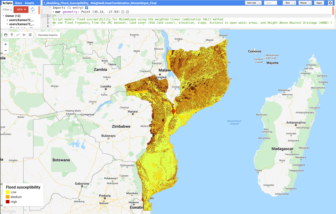
This blog tutorial will model flood susceptibility using EO datasets available in GEE. Readers can access the tutorial and GEE script at AI.Geolabs.