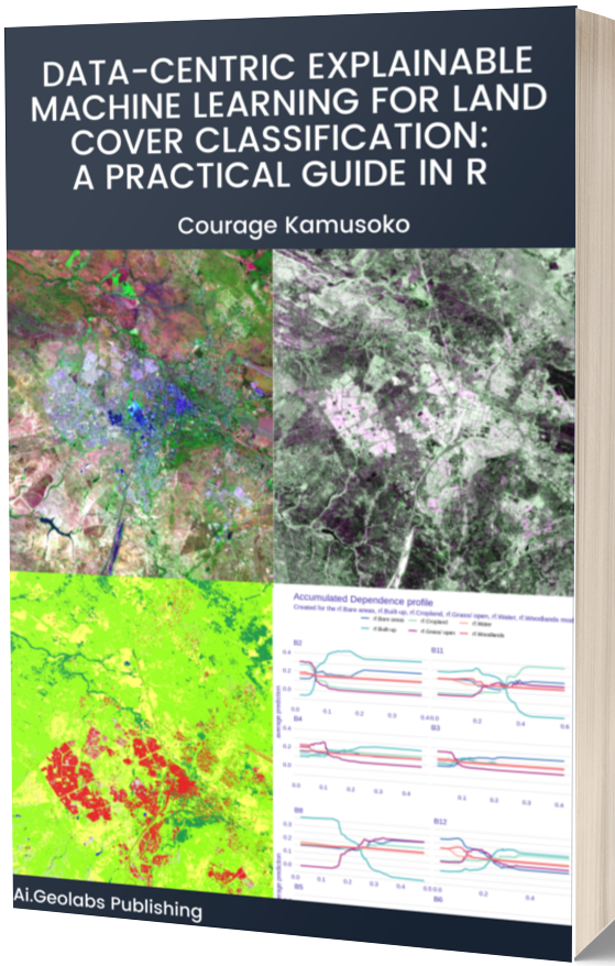
Introduction
Natural disasters are not new, but they have become more frequent and intense in recent years. Globally, natural disasters have resulted in the loss of life, caused severe damage to the environment, and disrupted the economy. Disaster risk management experts estimate that global losses from natural disasters have reached billions of dollars in the past few years. Most people in the least developing economies suffer the most from natural disasters. Therefore, reliable disaster risk management is required to help countries prepare, mitigate, and recover from the adverse impacts of natural disasters. Over the past decades, experts have been using machine learning techniques and geospatial data for disaster risk management.
Disaster risk management experts use machine learning techniques, and geospatial data to map settlements, assess damages, model disaster risk, and provide possible solutions to mitigate disasters. Experts have been using geospatial data, and other data sources such as social media feeds to provide disaster information in recent years. However, disaster risk management is still challenging, given the complexity of machine learning models and volumes of data (geospatial and non-geospatial). While machine learning algorithms have significantly improved, there is still little understanding of uncertainties and biases in disaster risk models. Furthermore, there is still a lack of explainability and trust in machine learning models, given the lack of clear communication between the experts and local communities in disaster zones.
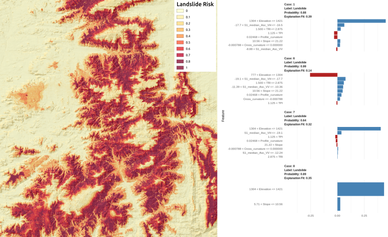
Data-centric Explainable Machine Learning for Landslide Risk Mapping
Landslides are one of the most dangerous disasters, causing loss of life and affecting socio-economic activities. A recent landslide in the Brazilian city of Petrópolis showed the extensive devastation of landslides. Disaster risk management experts warn that landslides would likely increase due to the severe climatic extremes and rapid unplanned urban expansions, especially in mountainous areas. There is a need for continuous data- and evidence-driven landslide susceptibility mapping to identify landslide-prone areas and reduce the impact of landslides. Experts can use GIS-based landslide risk mapping for disaster management to help local authorities and decision-makers prepare appropriate mitigation measures.
Landslide risk mapping plays a significant role in risk mitigation. However, the accuracy of the landslide risk model depends on the quality of geospatial data and other factors. The data-centric approach continuously improves the geospatial data quality and other ancillary data in landslide risk mapping. The explainable machine learning approach provides insights into how the models reach a decision. Experts update the landslide database and collect reliable driving factors (e.g., morphological, geological) in an iterative model development process in the data-centric explainable machine learning approach.
Next Steps
This blog post will use Sentinel 1, digital elevation model derivatives (e.g., slope, topographic ruggedness index), and the LIME method to gain insights into a random forest model. Readers can access the blog tutorial and download data sets in the links below.
There are many resources to learn about data-centric and explainable machine learning. You can also check my book to learn about data-centric explainable machine learning methods.